
 
Помощь сайту | Donate
 WMZ: 826074280762 WME: 804621616710 WMZ: 826074280762 WME: 804621616710
 4100117770549562
 Поиск по сайту
Вход на сайт
Меню
    Форум NoWa.cc На главную • Программы • Релизы • Наборы AIO • ОС • Мобила • Игры • Видео • Музыка • Книги • Аудиокниги • Оформление • Photoshop • Юмор • Новости • Железо • Разное Форум NoWa.cc На главную • Программы • Релизы • Наборы AIO • ОС • Мобила • Игры • Видео • Музыка • Книги • Аудиокниги • Оформление • Photoshop • Юмор • Новости • Железо • РазноеПоследние комментарии
16:36 | eduard33 14:52 | tinbin 08:05 | m4657 17:32 | marlon 16:13 | tinbin 13:31 | rory13 13:48 | marlon 12:10 | l0kid 14:38 | gofra 10:18 | Cthutq 04:37 | survilo 23:15 | marlon 19:01 | gruber 16:22 | server13 07:56 | leteha 02:36 | parallax1957 17:51 | diim 20:28 | tinbin 15:57 | rodrigokill 19:34 | marlonЗаказ рeклaмы
Купите у нас рекламу ! Your advertising could be here ! E-mail для связи: 
Партнёры
Для вас работают
 diim (админ) brodyga (админ) marlon leteha Ledworld Mansory1 Masarat manivell17 Sanchezzz sibius777 Sergv diim (админ) brodyga (админ) marlon leteha Ledworld Mansory1 Masarat manivell17 Sanchezzz sibius777 Sergv |
  Новость от: leteha
Просмотров: 365
Программа OkMap предназначена для работы с векторными и растровыми картами. Благодаря данному ПО можно производить калибровку растровых карт, обмениваться данными с GPS-устройством, составлять маршруты, треки и т.д.
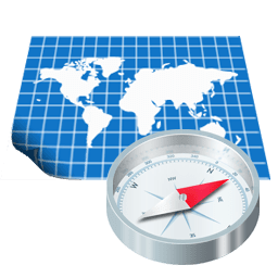 OkMap is a suite of cartographic applications (for Windows, iPad, iPhone) for professional activities in the field, outdoor sports, and your enjoyment in the nature (search and rescue, trekking, mountain bike, 4WD, geocaching and much more). Features: Characteristics • Display web maps for more than 40 servers • Ability to add new custom web map servers • Calibration / display raster maps (over 30 image formats) (video) • Display vectorial maps • Display hybrid maps (raster + vectorial data) • Ability to open multiple maps simultaneously • 10 cartographic projections of the most used • Representation of coordinates in: degrees, degrees-minutes, degrees-minutes-seconds, UTM, ECEF, Georef, US National Grid, British Grid (Ordnance Survey National Grid), Irish Grid, metric coordinates with custom projections • Database with over 3000 predefined projections by geographic area • Database with over 700 datum • Viewing 3D raster maps on Google Earth (for supported image formats) • Night vision • Map add-ons management (icons, comments) • Vectorial data management (point, multipoint, line, polygon) • GPX data management (waypoints, tracks, routes) • Files manager • Selecting multiple objects with the mouse • Context menu (right mouse) • Auto-info function • Zoom, autofit functions • Moving map function in 3 modes • Docking forms • Customizing toolbar • Showing yes / no toolbar • Showing yes / no statusbar • Check new releases at startup GPX data (waypoints, routes, tracks) • Creating / moving GPX data with the mouse (video) • Create tracks in "free hand" mode • List waypoints, routes, tracks and edit attributes • Deleting GPX data • GPX data search • Track statistics with more than 30 indicators • Track altitude profile and other 7 types of graphs • Track simplification • Track smoothing • Track altitudes smoothing • Duplicate track / route • Join tracks / routes • Join track segments • Divide track in multiple segments • Divide track in multiple tracks • Set DEM altitude to waypoints, routes and tracks • Loading GPX data recently opened • Download waypoints from OpenStreetMap Vectorial data (point, multipoint, line, polygon) • List vectorial themes and attributes management • Create / move vectorial data with the mouse • Edit vectorial data attributes • Delete vectorial data • Import vectorial data from ESRI data shapes • Download vectorial data from OpenStreetMap Toponyms • Import the toponyms from different sources (OziExplorer, Garmin POI, GPX) • Create toponyms with the mouse • Up to 3 classification types and altitude Photos • Create your own list of photos • Automatically manages all major image tag • See pictures drawn on the map • Show the orientation of the taken picture Map add-ons (icons, comments) • Creating / moving map add-ons with the mouse • Edit map add-ons attributes • Deleting map add-ons Maps management • Compute distances and areas on the map • Minimap display (thumbnail) • Magnifying lens display • Indexing / list / open maps • Meta/map display function and show map boundary • Search maps function • Map image print / save / copy to clipboard • Saving location / zoom of the map on close • Loading maps recently opened • Maps conversion from a format to another Grids • Displaying latitude / longitude grid • Displaying metric grid (alternative projection) Altimeter data • Using SRTM DEM data • Altitude display on the current mouse position • Automatic download of DEM data relating to current map • Showing DEM data boundaries on the map Map tiling • Output formats: Garmin custom maps, KML, KMZ, JNX, OruxMaps, TomTom map overlays and OkMap (video) • Automatic or manual setting of tiles number and size • Optimizing for Garmin custom maps and OruxMaps • Choice of tiles to generate • Orient the map to the north • Crop the map image • Resize the map image Google integration • Downloading and saving maps from Map Servers with automatic calibration • Google Maps viewing integration • Google Earth viewing integration (map + GPX data) Web services functions • Autorouting function • Geocoding function • Search geocache function Calculation and conversion features • Integration with GpsBabel front-end • Conversion GPX data to vectorial data • Conversion vectorial data to GPX data • Coordinate conversion functions • Coordinate conversion batch functions • Distances and azimuth conversion functions • Distances calculating functions • Areas calculating functions • Grid generator for research teams Communication with the GPS • Send GPX data to GPS devices (DeLorme PN20/30/40, Garmin, Magellan, NaviGPS GT-11/BGT-11) • Receive GPX data from GPS devices (Brauniger IQ series, DeLorme PN20/30/40, Garmin, GlobalSat DG-100/BT-335, Holux M-241, Magellan, MTK Logger, NaviGPS GT-11/BGT-11, SysTraq Venus, Wintec) Navigation • NMEA 0183 navigation • Automatic map centering during navigation • Automatic switching from one map to another • Display data navigation • Display data on satellites in view • Recording the "active log" track in real time • Storing waypoint in real time (man overboard) • Navigation toward a waypoint • Navigation along a route • Navigation along a track • Waypoint proximity alarm • Anchor alarm Remote devices and servers • Send tracks to remote OkMap and GpsGate servers • Receiving and viewing tracks in real time from OkMap, EasyTrails and OruxMaps remote devices • Receiving and viewing tracks in real time from GpsGate remote server Potential use • Search and rescue • Trekking • Mountain bike • Off road • Boating • Flying • Hunting and fishing • Finding mushrooms • Geocaching • Soft air Supported formats • Images: ECW, BMP, GIF, JPG, PNG, TIF and many others • Load maps: GFW, JGW, PGW, TFW, BPW (World file); ECW (Earth Resource Mapping - map with UTM projection are automatically georeferenced); KML/KMZ (Google Earth, Garmin Custom Maps); JNX Birdseye (one level, small maps); GeoTiff; OziExplorer; CompeGps; GPS TrackMaker; RMap; MBTiles; OruxMap; GpsTuner • Save maps: GeoTiff; World file; Garmin custom maps; KML/KMZ; JNX Birdseye; OziExplorer; OruxMaps; TomTom map overlays; GpsTuner • Maps tiling: Garmin custom maps; KML, KMZ, JNX, OruxMaps, TomTom map overlays and OkMap • Vectorial data: SHP, DBF (Esri shape file); DCW (Digital Chart of World) • GPS data: GPX; CompeGPS, EasyGPS, Fugawi, Garmin, Geocaching LOC, Google Earth (KML/KMZ), GPS TrackMaker, OpenStreetMap, OziExplorer and many others formats thanks to the software GpsBabel • DEM data: HGT (SRTM-1 and SRTM-3) Supported GPS devices • Upload/download: all new GPS devices that are handled as a mass storage device + Brauniger IQ series, DeLorme PN20/30/40, Garmin, GlobalSat DG-100/DG-200/BT-335, Holux M-241, Magellan, MiniHomer, MTK Logger, NaviGPS GT-11/BGT-11, SysTraq Venus, Wintec WBT-100/200 • NMEA navigation: all GPS devices that support Nmea 0183 protocol Supported Languages: - English - French - German - Italian - Русский - Slovenian - Spanish Основные возможности: • Калибровка векторных и растровых карт. • Создание собственных цифровых карт. • Отображение одновременно растровых карт и векторных данных. • Импорт цифровых векторных данных. • Цифровые модели местности для отображения возвышений на карте. • Загрузка и сохранение отметок, маршрутов и др. в формате GPX. • Загрузка информации с GPS-устройства. • Навигация в режиме настоящего времени по протоколу NMEA. • Отображение Google Earth и Google Maps. • Обмен данными с Google Earth и сервером gpsgate. Поддерживаемые форматы программой OkMap: • Изображения: ECW, BMP, GIF, JPG, PNG, TIF и многие другие. • Карты DRG: GFW, JGW, PGW, TFW, BPW. • Векторные данные: SHP, DBF (ESRI Shape файлов). • GPS данные: GPX (GPS Exchange Format); WPT, PLT, RTE (OziExplorer) и многие другие форматы, благодаря программному обеспечению GPSBabel. • DEM данные (цифровая модель Земли): HGT (СРТМ-1 и СРТМ-3). Официальный сайт | Home Page: http://www.okmap.org Размер | Size: 191.27 MB  OkMap Desktop 17.10 (x64) Multilingual + patch-MADARA Зеркало/Mirror - Up-load.io Зеркало/Mirror - NitroFlare.com Зеркало/Mirror - RapidGator.net Пароль/Password: www.2baksa.ws
Раздел: Программы | 14.05.23 | 12:47
|
|||||||||

|
Design by DolpHin | Disclaimer Реклама | E-mail для связи: |
Skype: diim_diim | ICQ: 400632 |
|

 Внимание! Всегда проверяйте анти-вирусом файлы, полученные по ссылкам в комментариях!Attention! Always check files you download from links in comments with your anti-virus software!