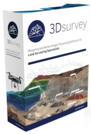
3Dsurvey 3.1.0
 Languages: Multilingual | File Size: 140 MB
From 2D images to accurate 3D models. Make the most out of the data you have and create 3D models that will amaze your clients.
-------------------------
От 2D-изображений до точных 3D-моделей. Используйте по максимуму имеющиеся у вас данные и создавайте 3D-модели, которые поразят ваших клиентов.
Best-in-Class Point Cloud
The technology of 3Dsurvey software prides itself on what matters the most – unparalleled precision resulting in detailed, dense and survey-grade accurate point clouds with as minimal noise levels as possible. You can create point clouds with data from drones, cameras, handheld devices, LIDAR, and GNSS! We are here to assist you with selecting the right hardware for mapping so you will get the best results to suit your needs.
Orthophoto
Whether you need traditional, true, or custom plane orthophoto – we have you covered! Orthophotos are geometrically corrected aerial or satellite images which have a variety of applications. They are commonly used for mapping and GIS, urban planning and development, environmental monitoring and management, engineering and industrial projects, disaster management and more.
Embrace the diversity and accuracy of our orthophoto generation capabilities for your next project.
Check additional information below and feel free to contact us with any additional questions.
Mesh
Meshes play a crucial role in surveying by providing a geometrically accurate representation of terrain and objects, enabling surveyors to analyze, visualize, and model the surveyed environment with precision. Meshes are commonly generated from point cloud data. After capturing the point cloud data, the software processes it to create a mesh representation. This process involves connecting neighboring points to form triangles or other polygons, resulting in a mesh that accurately reflects the surface geometry.
Classification
Experience the ease of semi-automatic point cloud classification with our advanced, user-friendly engine. Our cutting-edge technology with sophisticated customization tools for assigning new classes allows for precise and efficient object recognition, feature extraction and data filtering, and faster workflow.
Bounding box
The bounding box is a valuable tool for defining spatial extents, facilitating spatial analysis, and aiding in data visualization tasks. It provides a simple yet effective means of representing the geometric properties of features in surveying datasets.
Home Page - https://3dsurvey.si/products/3dsurvey/mapping-processing/
Download from file storage
3Dsurvey 3.1.0 (x64) + crack-LaVTeam
Users of Guests are not allowed to comment this publication.